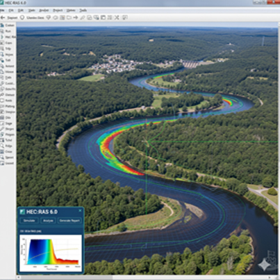
HEC-RAS (Hydrologic Engineering Center's River Analysis System)
What it does: This is the gold standard for flood mapping. It simulates how water flows down a channel and, crucially, how it spreads across a floodplain. The Question it Answers: "If this storm hits, which areas will be inundated, and exactly how deep will the water be?"
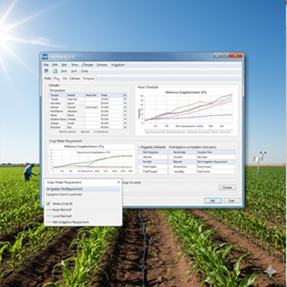
CROPWAT
What it does: A tool from the UN's Food and Agriculture Organization (FAO) that calculates precise crop water requirements. The Question it Answers: "When and how much water does my crop actually need to be most efficient?"
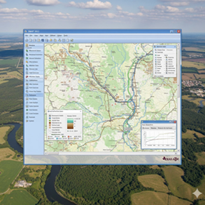
SWAT (Soil & Water Assessment Tool)
What it does: A "big picture" model that simulates an entire river basin. It models the full hydrologic cycle to see how land management practices impact water quality. The Question it Answers: "How do new crop rotations or fertilizer timings upstream affect nutrient pollution downstream?"
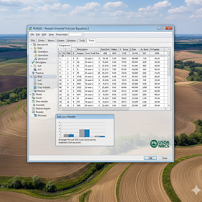
RUSLE2 (Revised Universal Soil Loss Equation 2)
What it does: The official USDA tool for predicting soil erosion caused by rainfall. Planners use it to test "what-if" scenarios for conservation. The Question it Answers: "How many tons of soil can I save if I switch to conservation tillage or plant a cover crop?"
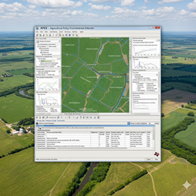
APEX (Agricultural Policy/Environmental eXtender)
What it does:A comprehensive simulation tool for a whole farm or small watershed. It doesn't just model water; it models the entire system, including nutrients (Nitrogen and Phosphorus) and pesticides. The Question it Answers: "What is the long-term environmental and economic impact of my nutrient management plan?"
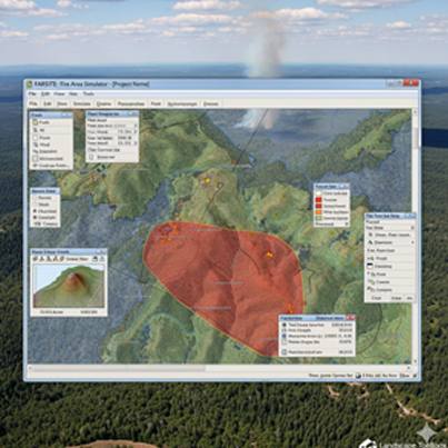
FARSITE (Fire Area Simulator)
What it does: A tactical model that simulates how a single fire will grow and spread over time, given the weather, fuels, and topography. The Question it Answers: "If a fire starts here, where will it be in 12 hours under this weather forecast?"
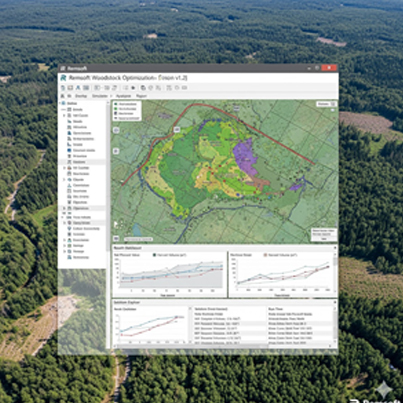
Woodstock
What it does: A powerful optimization platform for the timber industry. It uses Linear Programming to analyze all possible combinations of actions (like clearcutting or thinning) to find the single optimal plan. The Question it Answers: A powerful optimization platform for the timber industry. It uses Linear Programming to analyze all possible combinations of actions (like clearcutting or thinning) to find the single optimal plan.